
Thank you for supporting this site ❤️
Make a donation
Make a donation
Rott topographic map
Click on the map to display elevation.
Thank you for supporting this site ❤️
Make a donation
Make a donation
About this map
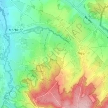
Name: Rott topographic map, elevation, terrain.
Location: Rott, Vijlen, Vaals, Limburg, Nederland, 6294 NL, Nederland (50.76736 5.92778 50.80736 5.96778)
Average elevation: 167 m
Minimum elevation: 96 m
Maximum elevation: 280 m
Thank you for supporting this site ❤️
Make a donation
Make a donation