
Senganan topographic map
Interactive map
Click on the map to display elevation.
About this map
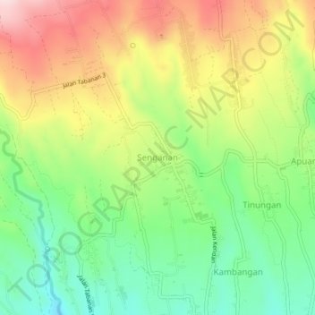
Name: Senganan topographic map, elevation, terrain.
Location: Senganan, Bali, 82191, Indonesien (-8.38977 115.13989 -8.34977 115.17989)
Average elevation: 617 m
Minimum elevation: 479 m
Maximum elevation: 794 m