
Yocalla topographic map
Interactive map
Click on the map to display elevation.
About this map
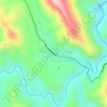
Name: Yocalla topographic map, elevation, terrain.
Average elevation: 3,465 m
Minimum elevation: 3,313 m
Maximum elevation: 3,749 m
Other topographic maps
Click on a map to view its topography, its elevation and its terrain.
Iscamayu
Bolivia > Potosí > Provincia Tomás Frías > Municipio Yocalla > Totora D
Iscamayu, Totora D, Municipio Yocalla, Provincia Tomás Frías, Potosí, Bolivia
Average elevation: 3,677 m