
Keulenberg topographic map
Interactive map
Click on the map to display elevation.
About this map
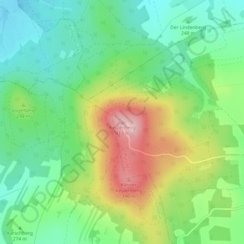
Name: Keulenberg topographic map, elevation, terrain.
Location: Keulenberg, Pulsnitz, Bautzen, Sachsen, Deutschland (51.22720 13.95583 51.22730 13.95593)
Average elevation: 279 m
Minimum elevation: 208 m
Maximum elevation: 401 m