
Thank you for supporting this site ❤️
Make a donation
Make a donation
Moorsel topographic map
Click on the map to display elevation.
Thank you for supporting this site ❤️
Make a donation
Make a donation
Moorsel
Moorsel ligt in Zandlemig Vlaanderen op een hoogte van 25-45 meter. De belangrijkste beek is de Molenbeek die in westelijke richting stroomt en in de Dender uitmondt.
Thank you for supporting this site ❤️
Make a donation
Make a donation
About this map
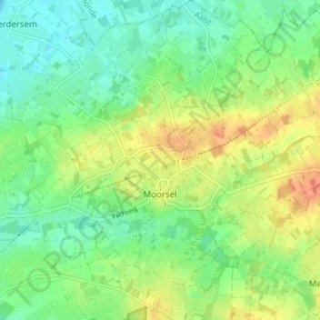
Name: Moorsel topographic map, elevation, terrain.
Location: Moorsel, Aalst, Oost-Vlaanderen, Vlaanderen, 9310, België (50.93067 4.07655 50.97409 4.12602)
Average elevation: 22 m
Minimum elevation: 4 m
Maximum elevation: 49 m
Thank you for supporting this site ❤️
Make a donation
Make a donation
Other topographic maps
Click on a map to view its topography, its elevation and its terrain.