
Thank you for supporting this site ❤️
Make a donation
Make a donation
Laketown topographic map
Click on the map to display elevation.
Thank you for supporting this site ❤️
Make a donation
Make a donation
About this map
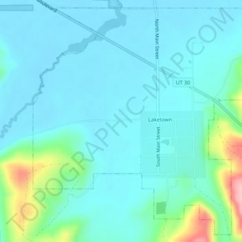
Name: Laketown topographic map, elevation, terrain.
Location: Laketown, Rich County, Utah, 84038, United States (41.81162 -111.34301 41.83895 -111.30395)
Average elevation: 1,839 m
Minimum elevation: 1,811 m
Maximum elevation: 1,978 m
Thank you for supporting this site ❤️
Make a donation
Make a donation
Other topographic maps
Click on a map to view its topography, its elevation and its terrain.