
Le Chesne topographic map
Interactive map
Click on the map to display elevation.
About this map
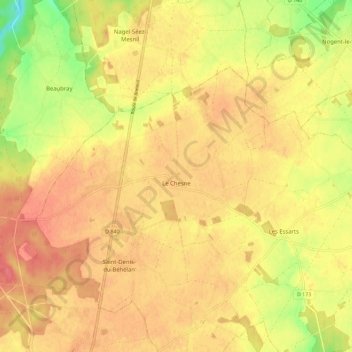
Name: Le Chesne topographic map, elevation, terrain.
Average elevation: 175 m
Minimum elevation: 137 m
Maximum elevation: 195 m
Other topographic maps
Click on a map to view its topography, its elevation and its terrain.
Chanteloup
France > Normandie > Eure > Marbois
Chanteloup, Marbois, Bernay, Eure, Normandie, France métropolitaine, 27240, France
Average elevation: 163 m
Les Essarts
France > Normandie > Eure > Marbois
Les Essarts, Marbois, Bernay, Eure, Normandie, France métropolitaine, 27240, France
Average elevation: 172 m