Bernheim Forest topographic map
Interactive map
Click on the map to display elevation.
About this map
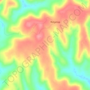
Name: Bernheim Forest topographic map, elevation, terrain.
Location: Bernheim Forest, Bullitt County, Kentucky, United States (37.90001 -85.62501 37.90011 -85.62491)
Average elevation: 230 m
Minimum elevation: 180 m
Maximum elevation: 272 m
Other topographic maps
Click on a map to view its topography, its elevation and its terrain.
Shepherdsville
United States > Kentucky > Bullitt County
Shepherdsville, Bullitt County, Kentucky, United States
Average elevation: 148 m
Brooks
United States > Kentucky > Bullitt County
Brooks, Bullitt County, Kentucky, 40109, United States
Average elevation: 189 m
Hillview
United States > Kentucky > Bullitt County
Hillview, Bullitt County, Kentucky, United States
Average elevation: 162 m
Mount Washington
United States > Kentucky > Bullitt County
Mount Washington, Bullitt County, Kentucky, 40047, United States
Average elevation: 184 m
Salt River
United States > Kentucky > Bullitt County > Shepherdsville
Salt River, Shepherdsville, Bullitt County, Kentucky, 40165, United States
Average elevation: 140 m
Phelps Knob
United States > Kentucky > Bullitt County
Phelps Knob, Bullitt County, Kentucky, 40165, United States
Average elevation: 161 m
Dawson Knob
United States > Kentucky > Bullitt County
Dawson Knob, Bullitt County, Kentucky, United States
Average elevation: 203 m