
Thank you for supporting this site ❤️
Make a donation
Make a donation
Magdalena topographic map
Click on the map to display elevation.
Thank you for supporting this site ❤️
Make a donation
Make a donation
Magdalena
The Very Large Array lies 24 miles due west of the community. The Magdalena Ridge Observatory lies 25 miles southeast at an elevation of 10,600 feet. Magdalena is located 26 miles west of Socorro.
Thank you for supporting this site ❤️
Make a donation
Make a donation
About this map
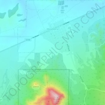
Name: Magdalena topographic map, elevation, terrain.
Average elevation: 2,056 m
Minimum elevation: 1,964 m
Maximum elevation: 2,482 m
Thank you for supporting this site ❤️
Make a donation
Make a donation
Other topographic maps
Click on a map to view its topography, its elevation and its terrain.