
Thank you for supporting this site ❤️
Make a donation
Make a donation
Sadău topographic map
Click on the map to display elevation.
Thank you for supporting this site ❤️
Make a donation
Make a donation
About this map
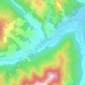
Name: Sadău topographic map, elevation, terrain.
Location: Sadău, Brodina, Сучава, 727069, Румыния (47.85635 25.38132 47.89635 25.42132)
Average elevation: 761 m
Minimum elevation: 580 m
Maximum elevation: 1,145 m
Thank you for supporting this site ❤️
Make a donation
Make a donation
Other topographic maps
Click on a map to view its topography, its elevation and its terrain.