
Thank you for supporting this site ❤️
Make a donation
Make a donation
Ypres topographic map
Click on the map to display elevation.
Thank you for supporting this site ❤️
Make a donation
Make a donation
About this map
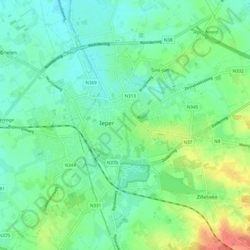
Name: Ypres topographic map, elevation, terrain.
Location: Ypres, Ieper, West Flanders, Flanders, 8900, Belgium (50.82831 2.85835 50.87493 2.95238)
Average elevation: 24 m
Minimum elevation: 9 m
Maximum elevation: 60 m
Thank you for supporting this site ❤️
Make a donation
Make a donation