
La Ruchaudière topographic map
Interactive map
Click on the map to display elevation.
About this map
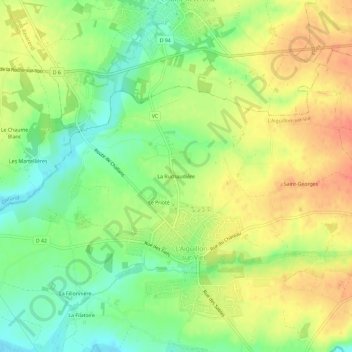
Name: La Ruchaudière topographic map, elevation, terrain.
Average elevation: 24 m
Minimum elevation: 0 m
Maximum elevation: 46 m
Other topographic maps
Click on a map to view its topography, its elevation and its terrain.
Le Prioté
France > Pays de la Loire > Vendée > L'Aiguillon-sur-Vie
Le Prioté, L'Aiguillon-sur-Vie, Les Sables-d'Olonne, Vendée, Pays de la Loire, France métropolitaine, 85220, France
Average elevation: 22 m