
Thank you for supporting this site ❤️
Make a donation
Make a donation
Sewanee topographic map
Click on the map to display elevation.
Thank you for supporting this site ❤️
Make a donation
Make a donation
Sewanee
Sewanee lies on the western edge of the Cumberland Plateau in the southeastern part of Middle Tennessee. It is located at 35°12′4″N 85°55′17″W / 35.20111°N 85.92139°W / 35.20111; -85.92139 (35.201232, -85.921524). It is at elevation 1,929 feet (588 m).
Thank you for supporting this site ❤️
Make a donation
Make a donation
About this map
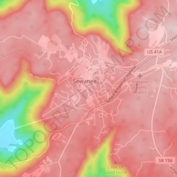
Name: Sewanee topographic map, elevation, terrain.
Average elevation: 539 m
Minimum elevation: 301 m
Maximum elevation: 620 m
Thank you for supporting this site ❤️
Make a donation
Make a donation
Other topographic maps
Click on a map to view its topography, its elevation and its terrain.