
Aungpan topographic map
Interactive map
Click on the map to display elevation.
About this map
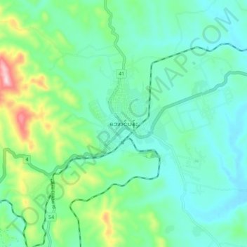
Name: Aungpan topographic map, elevation, terrain.
Average elevation: 1,329 m
Minimum elevation: 1,248 m
Maximum elevation: 1,598 m
Aungpan (Burmese: အောင်ပန်းမြို့) is a town located in the Southern Shan State. It is located in Kalaw Township which is part of Taunggyi District. It lies on the Thazi-Kyaingtong road at an elevation of 4219 feet (1286 meters) above sea level.