
Hötensleben topographic map
Interactive map
Click on the map to display elevation.
About this map
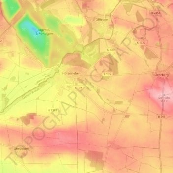
Name: Hötensleben topographic map, elevation, terrain.
Location: Hötensleben, Obere Aller, Börde, Saxony-Anhalt, 39393, Germany (52.08195 10.97738 52.14892 11.07815)
Average elevation: 109 m
Minimum elevation: 12 m
Maximum elevation: 163 m