
Thank you for supporting this site ❤️
Make a donation
Make a donation
Moggast topographic map
Click on the map to display elevation.
Thank you for supporting this site ❤️
Make a donation
Make a donation
Moggast
Das Pfarrdorf liegt im südlichen Randbereich der Wiesentalb. Es befindet sich etwa fünfeinhalb Kilometer ostsüdöstlich des Ortszentrums von Ebermannstadt und liegt auf einer Höhe von 493 m ü. NHN.
Thank you for supporting this site ❤️
Make a donation
Make a donation
About this map
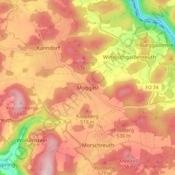
Name: Moggast topographic map, elevation, terrain.
Average elevation: 473 m
Minimum elevation: 308 m
Maximum elevation: 569 m
Thank you for supporting this site ❤️
Make a donation
Make a donation