
Massendorf topographic map
Interactive map
Click on the map to display elevation.
About this map
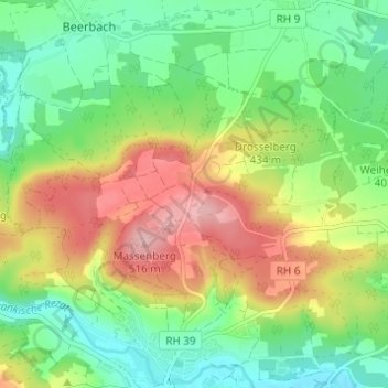
Name: Massendorf topographic map, elevation, terrain.
Location: Massendorf, Landkreis Roth, Bayern, 91174, Deutschland (49.17654 10.90847 49.21654 10.94847)
Average elevation: 417 m
Minimum elevation: 355 m
Maximum elevation: 509 m