
Orsières topographic map
Interactive map
Click on the map to display elevation.
About this map
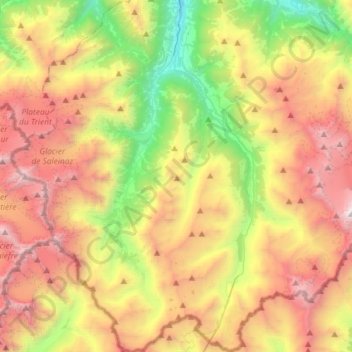
Name: Orsières topographic map, elevation, terrain.
Location: Orsières, Entremont, Valais, 2303, Suisse (45.85831 7.00897 46.06039 7.20137)
Average elevation: 2,331 m
Minimum elevation: 792 m
Maximum elevation: 4,143 m
Sur la commune d'Orsières se trouvent les stations touristiques de Champex-Lac, à environ 1 500 m d'altitude et de La Fouly, à environ 1 600 m d'altitude.
Other topographic maps
Click on a map to view its topography, its elevation and its terrain.