
Boßdorf topographic map
Interactive map
Click on the map to display elevation.
About this map
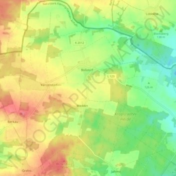
Name: Boßdorf topographic map, elevation, terrain.
Average elevation: 143 m
Minimum elevation: 102 m
Maximum elevation: 188 m
Other topographic maps
Click on a map to view its topography, its elevation and its terrain.
Lutherstadt Wittenberg
Deutschland > Sachsen-Anhalt > Lutherstadt Wittenberg
Lutherstadt Wittenberg, Wittenberg, Sachsen-Anhalt, 06886, Deutschland
Average elevation: 79 m