
Barber County topographic map
Interactive map
Click on the map to display elevation.
About this map
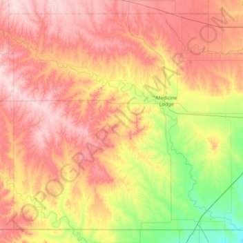
Name: Barber County topographic map, elevation, terrain.
Location: Barber County, Kansas, United States (36.99796 -99.01356 37.47163 -98.34715)
Average elevation: 507 m
Minimum elevation: 380 m
Maximum elevation: 630 m
Other topographic maps
Click on a map to view its topography, its elevation and its terrain.
Medicine Lodge
United States > Kansas > Barber County > Medicine Lodge
Medicine Lodge, Barber County, Kansas, 67104, United States
Average elevation: 457 m