
Thank you for supporting this site ❤️
Make a donation
Make a donation
Ruabon topographic map
Click on the map to display elevation.
Thank you for supporting this site ❤️
Make a donation
Make a donation
About this map
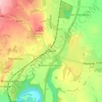
Name: Ruabon topographic map, elevation, terrain.
Location: Ruabon, Wrexham, Wales, LL14 6DG, United Kingdom (52.96713 -3.06150 53.00713 -3.02150)
Average elevation: 124 m
Minimum elevation: 46 m
Maximum elevation: 207 m
Thank you for supporting this site ❤️
Make a donation
Make a donation
Other topographic maps
Click on a map to view its topography, its elevation and its terrain.