
Thank you for supporting this site ❤️
Make a donation
Make a donation
Creuse topographic map
Click on the map to display elevation.
Thank you for supporting this site ❤️
Make a donation
Make a donation
Creuse
It is in the Massif Central and permeated by the Creuse and its tributaries. The river is dammed at several locations both for water supply and hydroelectricity generation. As is typical for an inland area of continental Europe, Creuse has relatively cold winters with some snowfall into April, but also hot summers. Rain falls throughout the year because of the relatively high elevation.
Thank you for supporting this site ❤️
Make a donation
Make a donation
About this map
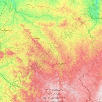
Name: Creuse topographic map, elevation, terrain.
Location: Creuse, New Aquitaine, Metropolitan France, France (45.66337 1.37254 46.45534 2.61150)
Average elevation: 503 m
Minimum elevation: 151 m
Maximum elevation: 977 m
Thank you for supporting this site ❤️
Make a donation
Make a donation