
Lake Albert topographic map
Interactive map
Click on the map to display elevation.
About this map
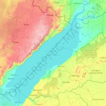
Name: Lake Albert topographic map, elevation, terrain.
Location: Lake Albert, Hoima, Western Region, Uganda (0.99799 30.35050 2.51413 31.53419)
Average elevation: 1,076 m
Minimum elevation: 607 m
Maximum elevation: 2,389 m