
Thank you for supporting this site ❤️
Make a donation
Make a donation
Naundorf topographic map
Click on the map to display elevation.
Thank you for supporting this site ❤️
Make a donation
Make a donation
About this map
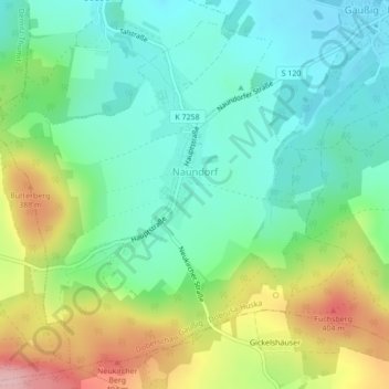
Name: Naundorf topographic map, elevation, terrain.
Location: Naundorf, Doberschau-Gaußig, Bautzen, Sachsen, Deutschland (51.11019 14.27274 51.13434 14.30742)
Average elevation: 315 m
Minimum elevation: 255 m
Maximum elevation: 436 m
Thank you for supporting this site ❤️
Make a donation
Make a donation