
Thank you for supporting this site ❤️
Make a donation
Make a donation
Elyria topographic map
Click on the map to display elevation.
Thank you for supporting this site ❤️
Make a donation
Make a donation
About this map
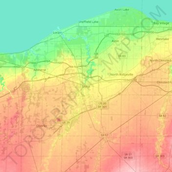
Name: Elyria topographic map, elevation, terrain.
Location: Elyria, Lorain County, Ohio, 44035, United States (41.20732 -82.26736 41.52732 -81.94736)
Average elevation: 223 m
Minimum elevation: 165 m
Maximum elevation: 293 m
Thank you for supporting this site ❤️
Make a donation
Make a donation