
Thank you for supporting this site ❤️
Make a donation
Make a donation
Marpola ridge topographic map
Click on the map to display elevation.
Thank you for supporting this site ❤️
Make a donation
Make a donation
About this map
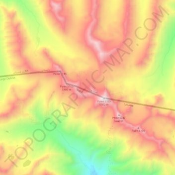
Name: Marpola ridge topographic map, elevation, terrain.
Location: Marpola ridge, Kargil Tehsil, Kargil District, Ladakh, India (34.49372 75.63909 34.56902 75.75197)
Average elevation: 4,610 m
Minimum elevation: 3,726 m
Maximum elevation: 5,335 m
Thank you for supporting this site ❤️
Make a donation
Make a donation
Other topographic maps
Click on a map to view its topography, its elevation and its terrain.