
Thank you for supporting this site ❤️
Make a donation
Make a donation
Chesapeake City topographic map
Click on the map to display elevation.
Thank you for supporting this site ❤️
Make a donation
Make a donation
About this map
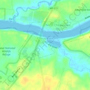
Name: Chesapeake City topographic map, elevation, terrain.
Location: Chesapeake City, Cecil County, Maryland, United States (39.51841 -75.82293 39.53286 -75.79753)
Average elevation: 11 m
Minimum elevation: -4 m
Maximum elevation: 26 m
Thank you for supporting this site ❤️
Make a donation
Make a donation
Other topographic maps
Click on a map to view its topography, its elevation and its terrain.
Thank you for supporting this site ❤️
Make a donation
Make a donation
Thank you for supporting this site ❤️
Make a donation
Make a donation