
Bennachie topographic map
Interactive map
Click on the map to display elevation.
About this map
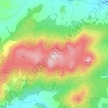
Name: Bennachie topographic map, elevation, terrain.
Location: Bennachie, Auchleven, Aberdeenshire, Scotland, United Kingdom (57.28142 -2.61815 57.30704 -2.51634)
Average elevation: 262 m
Minimum elevation: 84 m
Maximum elevation: 516 m
Mither Tap has an astronomical alignment with the nearby Pictish Fortalice of Caskieben (currently located within Keith Hall). Dr. Arthur Johnston said "the hill of Benochie, a conical elevation about eight miles distant, casts its shadow over Caskieben at the periods of the equinox."