
Thank you for supporting this site ❤️
Make a donation
Make a donation
Unterklausen topographic map
Click on the map to display elevation.
Thank you for supporting this site ❤️
Make a donation
Make a donation
About this map
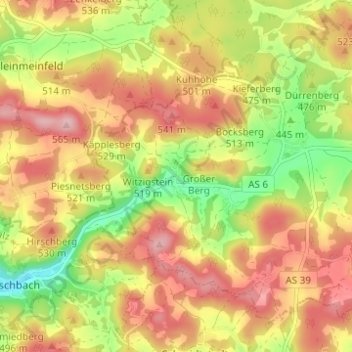
Name: Unterklausen topographic map, elevation, terrain.
Average elevation: 480 m
Minimum elevation: 383 m
Maximum elevation: 558 m
Thank you for supporting this site ❤️
Make a donation
Make a donation
Other topographic maps
Click on a map to view its topography, its elevation and its terrain.
Stadionberg
Deutschland > Bayern > Landkreis Amberg-Sulzbach > Hirschbach > Oberklausen
Average elevation: 478 m