
Thank you for supporting this site ❤️
Make a donation
Make a donation
Cambridge City topographic map
Click on the map to display elevation.
Thank you for supporting this site ❤️
Make a donation
Make a donation
About this map
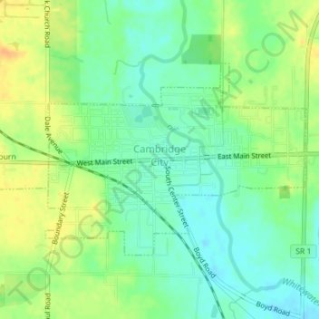
Name: Cambridge City topographic map, elevation, terrain.
Location: Cambridge City, Wayne County, Indiana, United States (39.80446 -85.18352 39.82070 -85.15471)
Average elevation: 292 m
Minimum elevation: 278 m
Maximum elevation: 310 m
Thank you for supporting this site ❤️
Make a donation
Make a donation
Other topographic maps
Click on a map to view its topography, its elevation and its terrain.