
Make a donation
Fallon topographic map
Click on the map to display elevation.
Make a donation
Fallon
Fallon experiences a cold desert climate, with hot summers and cold winters. Due to Fallon's elevation and aridity, the diurnal temperature variation is quite substantial, especially in the summer months. Fallon's climate is quite dry, due to its location in the rain shadow of the Sierra Nevada. Summer days can be hot, but temperatures are cooler than in deserts such as the Mojave, Sonoran, and Chihuahuan deserts, due to Fallon's altitude and higher latitude north of the equator. In the winter, daytime temperatures are usually above freezing, but nights can be bitterly cold. Fallon can experience heavy fog in winter, known as pogonip.
Make a donation
About this map
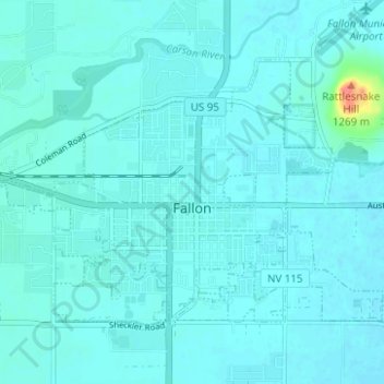
Name: Fallon topographic map, elevation, terrain.
Location: Fallon, Churchill County, Nevada, United States (39.45991 -118.80916 39.49310 -118.74695)
Average elevation: 1,210 m
Minimum elevation: 1,204 m
Maximum elevation: 1,271 m
Make a donation
Other topographic maps
Click on a map to view its topography, its elevation and its terrain.