
Thomas-Müntzer-Siedlung topographic map
Interactive map
Click on the map to display elevation.
About this map
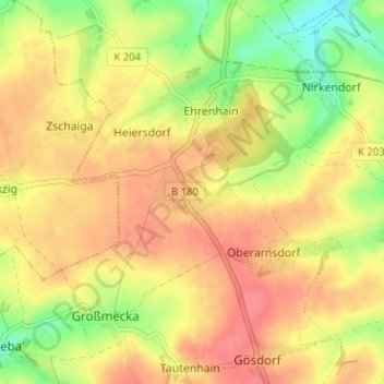
Name: Thomas-Müntzer-Siedlung topographic map, elevation, terrain.
Average elevation: 248 m
Minimum elevation: 212 m
Maximum elevation: 272 m
Other topographic maps
Click on a map to view its topography, its elevation and its terrain.
Nobitz
Deutschland > Thüringen > Altenburger Land > Nobitz
Nobitz, Altenburger Land, Thüringen, 04603, Deutschland
Average elevation: 229 m