
Puy Neige topographic map
Interactive map
Click on the map to display elevation.
About this map
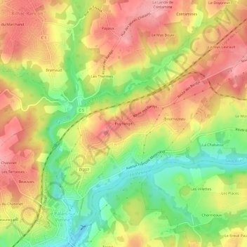
Name: Puy Neige topographic map, elevation, terrain.
Average elevation: 291 m
Minimum elevation: 223 m
Maximum elevation: 345 m
Other topographic maps
Click on a map to view its topography, its elevation and its terrain.
Le Super Palais
France > Nouvelle-Aquitaine > Haute-Vienne > Le Palais-sur-Vienne
Le Super Palais, Le Palais-sur-Vienne, Limoges, Haute-Vienne, Nouvelle-Aquitaine, France métropolitaine, 87410, France
Average elevation: 298 m