
Thank you for supporting this site ❤️
Make a donation
Make a donation
Leinburg topographic map
Click on the map to display elevation.
Thank you for supporting this site ❤️
Make a donation
Make a donation
About this map
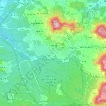
Name: Leinburg topographic map, elevation, terrain.
Location: Leinburg, Nürnberger Land, Bavaria, 91227, Germany (49.40787 11.27004 49.48337 11.38686)
Average elevation: 403 m
Minimum elevation: 326 m
Maximum elevation: 610 m
Thank you for supporting this site ❤️
Make a donation
Make a donation
Other topographic maps
Click on a map to view its topography, its elevation and its terrain.