
Sakarya topographic map
Interactive map
Click on the map to display elevation.
About this map
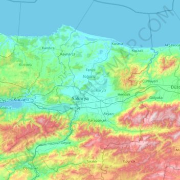
Name: Sakarya topographic map, elevation, terrain.
Location: Sakarya, Marmara Region, Turkey (40.28609 29.96698 41.35100 31.01248)
Average elevation: 361 m
Minimum elevation: 0 m
Maximum elevation: 1,833 m