
Sigus topographic map
Interactive map
Click on the map to display elevation.
About this map
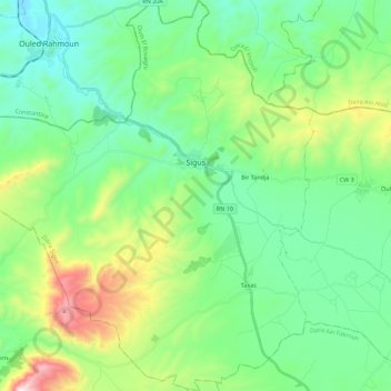
Name: Sigus topographic map, elevation, terrain.
Location: Sigus, Daïra Sigus, Oum El Bouaghi, Algérie (36.01809 6.63170 36.19874 6.85315)
Average elevation: 892 m
Minimum elevation: 640 m
Maximum elevation: 1,610 m
Other topographic maps
Click on a map to view its topography, its elevation and its terrain.
Mechtet Laachichat
Algérie > Oum El Bouaghi > Daïra Sigus > El Amiria > Aïn El Bordj
Mechtet Laachichat, Aïn El Bordj, El Amiria, Daïra Sigus, Oum El Bouaghi, Algérie
Average elevation: 913 m