
La Fournière topographic map
Interactive map
Click on the map to display elevation.
About this map
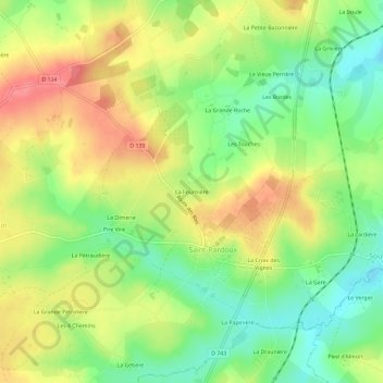
Name: La Fournière topographic map, elevation, terrain.
Average elevation: 197 m
Minimum elevation: 161 m
Maximum elevation: 234 m
Other topographic maps
Click on a map to view its topography, its elevation and its terrain.
Saint-Pardoux
France > Nouvelle-Aquitaine > Deux-Sèvres > Saint-Pardoux-Soutiers
Saint-Pardoux, Saint-Pardoux-Soutiers, Parthenay, Deux-Sèvres, Nouvelle-Aquitaine, France métropolitaine, 79310, France
Average elevation: 196 m
Soutiers
France > Nouvelle-Aquitaine > Deux-Sèvres > Saint-Pardoux-Soutiers
Soutiers, Saint-Pardoux-Soutiers, Parthenay, Deux-Sèvres, Nouvelle-Aquitaine, France métropolitaine, 79310, France
Average elevation: 177 m