
Thank you for supporting this site ❤️
Make a donation
Make a donation
Towanda topographic map
Click on the map to display elevation.
Thank you for supporting this site ❤️
Make a donation
Make a donation
About this map
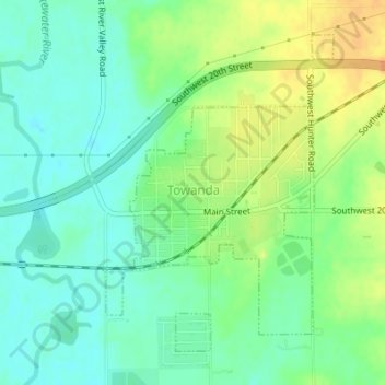
Name: Towanda topographic map, elevation, terrain.
Location: Towanda, Butler County, Kansas, United States (37.78615 -97.00756 37.80837 -96.98728)
Average elevation: 393 m
Minimum elevation: 379 m
Maximum elevation: 412 m
Thank you for supporting this site ❤️
Make a donation
Make a donation