
城关镇 topographic map
Interactive map
Click on the map to display elevation.
About this map
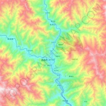
Name: 城关镇 topographic map, elevation, terrain.
Location: 城关镇, 卡若区, 昌都市, 西藏自治区, 中国 (31.05456 97.05884 31.26042 97.28479)
Average elevation: 3,933 m
Minimum elevation: 3,190 m
Maximum elevation: 4,941 m
Other topographic maps
Click on a map to view its topography, its elevation and its terrain.