
Chaguarpamba topographic map
Interactive map
Click on the map to display elevation.
About this map
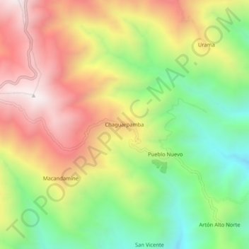
Name: Chaguarpamba topographic map, elevation, terrain.
Location: Chaguarpamba, Parroquia Utuana, Cantón Calvas, Loja, Ecuador (-4.38651 -79.70626 -4.34651 -79.66626)
Average elevation: 2,007 m
Minimum elevation: 1,459 m
Maximum elevation: 2,597 m