
Thank you for supporting this site ❤️
Make a donation
Make a donation
Standing Pine topographic map
Click on the map to display elevation.
Thank you for supporting this site ❤️
Make a donation
Make a donation
About this map
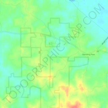
Name: Standing Pine topographic map, elevation, terrain.
Location: Standing Pine, Leake County, Mississippi, United States (32.65355 -89.47337 32.69408 -89.43331)
Average elevation: 127 m
Minimum elevation: 104 m
Maximum elevation: 168 m
Thank you for supporting this site ❤️
Make a donation
Make a donation
Other topographic maps
Click on a map to view its topography, its elevation and its terrain.