
Neuhouse topographic map
Interactive map
Click on the map to display elevation.
About this map
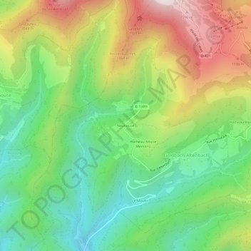
Name: Neuhouse topographic map, elevation, terrain.
Average elevation: 794 m
Minimum elevation: 428 m
Maximum elevation: 1,343 m
Other topographic maps
Click on a map to view its topography, its elevation and its terrain.
Hameau Blanschen
France > Grand Est > Haut-Rhin > Goldbach-Altenbach
Hameau Blanschen, Goldbach-Altenbach, Thann-Guebwiller, Haut-Rhin, Grand Est, France métropolitaine, 68760, France
Average elevation: 840 m
Grand Ballon
France > Grand Est > Haut-Rhin > Goldbach-Altenbach
Grand Ballon, Goldbach-Altenbach, Thann-Guebwiller, Haut-Rhin, Grand Est, France métropolitaine, 68760, France
Average elevation: 1,139 m