Sint-Gertrudis-Pede topographic map
Interactive map
Click on the map to display elevation.
About this map
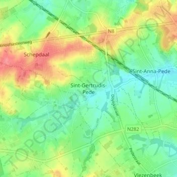
Name: Sint-Gertrudis-Pede topographic map, elevation, terrain.
Average elevation: 56 m
Minimum elevation: 30 m
Maximum elevation: 94 m

Click on the map to display elevation.
Name: Sint-Gertrudis-Pede topographic map, elevation, terrain.
Average elevation: 56 m
Minimum elevation: 30 m
Maximum elevation: 94 m