
Kerivual topographic map
Interactive map
Click on the map to display elevation.
About this map
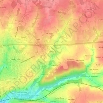
Name: Kerivual topographic map, elevation, terrain.
Average elevation: 98 m
Minimum elevation: 43 m
Maximum elevation: 127 m
Other topographic maps
Click on a map to view its topography, its elevation and its terrain.
Kervatret
France > Bretagne > Finistère > Landivisiau
Kervatret, Landivisiau, Morlaix, Finistère, Bretagne, France métropolitaine, 29400, France
Average elevation: 79 m