
召市镇 topographic map
Interactive map
Click on the map to display elevation.
About this map
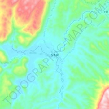
Name: 召市镇 topographic map, elevation, terrain.
Location: 召市镇, 龙山县, 湘西土家族苗族自治州, 湖南省, 中国 (29.19917 109.37688 29.27917 109.45688)
Average elevation: 777 m
Minimum elevation: 606 m
Maximum elevation: 1,331 m
Other topographic maps
Click on a map to view its topography, its elevation and its terrain.