
Kerautret Huella topographic map
Interactive map
Click on the map to display elevation.
About this map
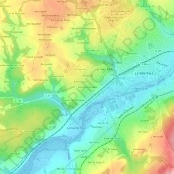
Name: Kerautret Huella topographic map, elevation, terrain.
Average elevation: 58 m
Minimum elevation: -4 m
Maximum elevation: 148 m
Other topographic maps
Click on a map to view its topography, its elevation and its terrain.
Lavallot
France > Bretagne > Finistère > Landerneau
Lavallot, Landerneau, Brest, Finistère, Bretagne, France métropolitaine, 29800, France
Average elevation: 79 m
La Gare
France > Bretagne > Finistère > Landerneau
La Gare, Landerneau, Brest, Finistère, Bretagne, France métropolitaine, 29800, France
Average elevation: 63 m