
Thank you for supporting this site ❤️
Make a donation
Make a donation
Mountain View topographic map
Click on the map to display elevation.
Thank you for supporting this site ❤️
Make a donation
Make a donation
About this map
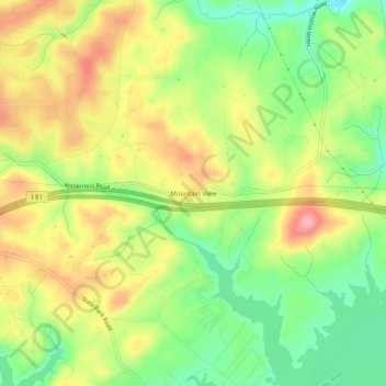
Name: Mountain View topographic map, elevation, terrain.
Location: Mountain View, Pulaski County, Virginia, United States (37.06818 -80.64034 37.10818 -80.60034)
Average elevation: 594 m
Minimum elevation: 539 m
Maximum elevation: 653 m
Thank you for supporting this site ❤️
Make a donation
Make a donation
Other topographic maps
Click on a map to view its topography, its elevation and its terrain.