
Carnforth topographic map
Interactive map
Click on the map to display elevation.
About this map
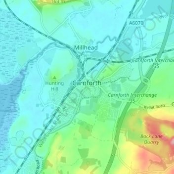
Name: Carnforth topographic map, elevation, terrain.
Average elevation: 28 m
Minimum elevation: 0 m
Maximum elevation: 139 m
Other topographic maps
Click on a map to view its topography, its elevation and its terrain.
River Lune
Vereinigtes Königreich > England > Lancashire > Lancaster > Caton > Halton Green
River Lune, Halton Green, Halton-with-Aughton, Caton, Lancaster, Lancashire, England, Vereinigtes Königreich
Average elevation: 52 m