
Thank you for supporting this site ❤️
Make a donation
Make a donation
Stagsden topographic map
Click on the map to display elevation.
Thank you for supporting this site ❤️
Make a donation
Make a donation
About this map
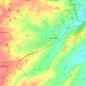
Name: Stagsden topographic map, elevation, terrain.
Location: Stagsden, Bedford, England, United Kingdom (52.10454 -0.60821 52.15168 -0.53649)
Average elevation: 69 m
Minimum elevation: 35 m
Maximum elevation: 105 m
Thank you for supporting this site ❤️
Make a donation
Make a donation