
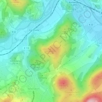
Burgruine Hohenfels topographic map
Interactive map
Click on the map to display elevation.
About this map
Name: Burgruine Hohenfels topographic map, elevation, terrain.
Average elevation: 293 m
Minimum elevation: 229 m
Maximum elevation: 458 m
Other topographic maps
Click on a map to view its topography, its elevation and its terrain.
Dautphe
Deutschland > Hessen > Dautphetal
Dautphe, Dautphetal, Landkreis Marburg-Biedenkopf, Regierungsbezirk Gießen, Hessen, Deutschland
Average elevation: 341 m
Hilsbach
Deutschland > Hessen > Dautphetal
Hilsbach, Dautphetal, Landkreis Marburg-Biedenkopf, Hessen, Deutschland
Average elevation: 444 m